To Red Canyon and Hance Rapids
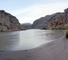
We hit the trail around 9:00, both with at least one empty canten as we saw no need to carry extra water. We could always
top out at Hance Rapids. We took the high route west because it was the obvious trail. We probably could
have taken the low road, but didn't check the trail description to know it was there. After a descent to Papago
Creek, we had to climb the 50' cliff. We did it with packs and had no real difficulty. The route description
warns that the next section is confusing, and it's correct. There are several sets of cairns, and it's easy
to take a false trail. After reaching the top it was a matter of yards to the top of the talus field. We reached the
top of the talus field around 10:15, and it took us about 20 minutes to climb down it.
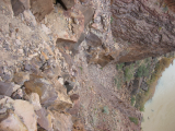 No, this picture isn't tilted. The talus field is that steep, and the river is on the right.
Hance Rapids to Hance Creek via the Tonto Trail
After dropping down the Talus field to get to Hance Rapids, we followed the beach for a while, then
picked up the Tonto trail as it slowly climbed away from the river. Mike took this opportunity to
top out his water. I thought (incorrectly) that I had more than enough. The trail wound its way up for a
while, then it leveled off. We stopped for a quick (20 minute) lunch around 12:00 after a good climb, then continued on.
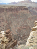
We made good time as we followed the contours right next to incredible
dropoffs, reaching Hance Creek about 3:15. Well before this I had drained my Platapus and canteen, so I found a spot in
the creek deep enough to fill my canteens and refilled. We had planned on staying here for the night, but the gnats
were very annoying. Mike thought he remembered being told there was a spot to stay at Miner's spring, so after 15 minutes
we got moving again.
Hance Creek to Miner's Spring and The Last Chance Mine
About 4:15 we reached Miners' (Page) Spring. It sits just off a large drainage that comes off Horseshoe
Mesa, in a very narrow and steep spot. You might camp there in an emergency, but with a forecast of rain and/or snow,
we decided that would not only be very uncomfortable, but stupid. We filled up everything we could cary water in as
this was the last opportunity we would have, then pressed on after about a 20 minute stop. We expected it would be dark by
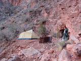
the time we reached the top of Horseshoe Mesa. About 5:15 we came to the entrance to the Last Chance mine. A perfectly level tailings pile presented the perfect place to pitch our small tent.
We quickly made camp, ate dinner, and relaxed for a while, grateful to find such an excellent spot.
Prev
Intro
Next
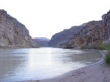

 We hit the trail around 9:00, both with at least one empty canten as we saw no need to carry extra water. We could always
top out at Hance Rapids. We took the high route west because it was the obvious trail. We probably could
have taken the low road, but didn't check the trail description to know it was there. After a descent to Papago
Creek, we had to climb the 50' cliff. We did it with packs and had no real difficulty. The route description
warns that the next section is confusing, and it's correct. There are several sets of cairns, and it's easy
to take a false trail. After reaching the top it was a matter of yards to the top of the talus field. We reached the
top of the talus field around 10:15, and it took us about 20 minutes to climb down it.
 No, this picture isn't tilted. The talus field is that steep, and the river is on the right.